 vesseltracker.com
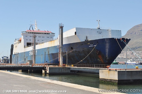
Vessel JABAL ALI 10 IMO: 8501476, MMSI: 620800250 Ro-Ro Cargo
UTC, 25.12266, 54.84289, course: 72, speed: 0.7
UTC, 25.12260, 54.84294, course: -1, speed: 0.4
2026-03-01 06:00:46 UTC, 25.12298, 54.84273, course: -1, speed: 0.6
Live AIS position:
UTC. 11 nm NW of Jebel Ali),
updated 2026-03-01 06:00:46 UTC.
Find the position of the vessel JABAL ALI 10 on the map. The latter are known coordinates and path.
marine traffic ship tracker show on live map
The current position of vessel JABAL ALI 10 is 25.12298 lat / 54.84273 lng. Updated: 2026-03-01 06:00:46 UTCCurrently sailing under the flag of Comoros
Details:
Last coordinates of the vessel:
UTC, 25.12206, 54.84317, course: -1, speed: 0.2UTC, 25.12266, 54.84289, course: 72, speed: 0.7
UTC, 25.12260, 54.84294, course: -1, speed: 0.4
2026-03-01 06:00:46 UTC, 25.12298, 54.84273, course: -1, speed: 0.6